Civil Surveying lays the groundwork for a successful construction project. This guide will give you the basics about initial civil surveys, survey types and how they’re used, and the advantages of multiple surveys. Whether you’re new to big construction or have a few projects under your belt, this guide will help you understand the MJE process and how it saves clients time and money.
Importance of Initial Civil Surveys
Long before a dollar figure is ever estimated and well before the initial excavation work begins, a single civil surveyor or small surveyor team will gather the initial data that guides the construction trajectory. The quality of the initial survey is paramount for a designer or engineer to begin their work. Quality civil surveys:
- Resolve potential legal issues by solidifying boundaries and establishing land ownership.
- Identify possible roadblocks that could interfere with design or construction.
- Organizes information for bidders, engineers, and designers to submit their most accurate work.
Predominant Survey Types
Two survey types are typically used to establish the data to draw up construction plans. Each type has its benefits and works best when used collaboratively.
AERIAL SURVEYS
Aerial (drone) surveys are faster and easier to complete than traditional land surveys. Using high-tech drones with GPS coordinates, pilots can gather elevation and topographical data. Drones use high-definition imaging to map an area with valuable images that engineers and designers can use to determine how best to lay out their plans.
Aerial surveys are used before, during, and after a project. Drones only take one person to run them, and flight speed increases every year, making it a fast and cost-effective way to measure the accuracy and efficiency of the construction.
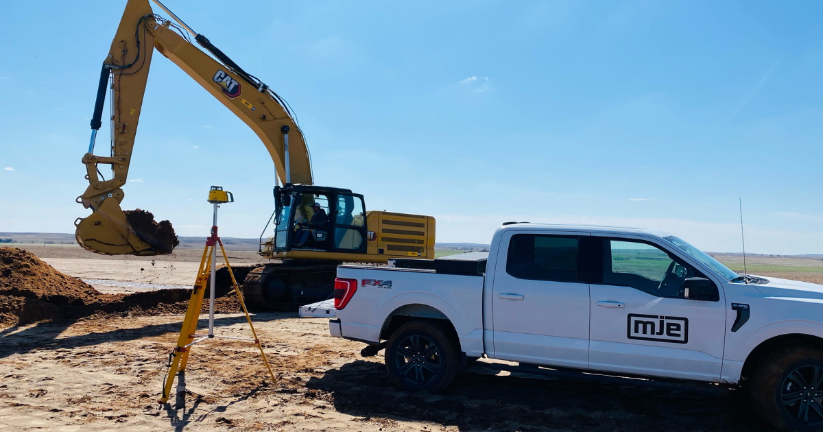
TERRESTRIAL LAND SURVEYS
Terrestrial Land surveys are a traditional means to gather important elevation and topographical data. This data is collected from the ground using high-tech tablets, GPS coordinates, and typically one or two surveyors. The information is used to cross-check aerial footage to ensure the land is plotted correctly.
High vegetation areas with thick plant density can lead to inaccuracies with aerial footage. However, a conventional land surveyor can get unmatched elevation data in these areas. Using both types of surveys leads to the most accurate data right from the start.
“Drone surveys create a blanket over the area of a project, and land surveys provide the borders or boundaries. You need both for the most accurate data at the beginning of a project.”
Abe Driedger, Jr, Lead Surveyor, MJE LLC
Advantages to Multiple Surveys
Drone survey capabilities increase efficiencies throughout a civil construction project. Drone surveys are a fast way to check on earthwork. They can be flown in a few hours or less and only take one person to pilot the drone. Clients and Project Managers can use the information to solidify schedules and project timelines.
Another advantage to multiple civil surveys is to cross-check data points. Another advantage to multiple civil surveys is to cross-check data points. On occasion, surveyors may find discrepancies in the data. When this happens, the MJE surveyors work closely with engineers and state surveyors to get it right before the work begins. They collaborate by sharing potentially disrupted coordinates and invert imaging to ensure no tilt in the data. In addition, surveyors check all control points for accuracy.
Once a project is complete, MJE completes an in-depth analysis to look for ways to improve construction. Flying drones to collect survey data frequently throughout a project can identify areas of improvement and help estimators & project managers provide the best information to clients.
Conclusion
Civil Surveying is the backbone of a quality construction project. All subsequent work (estimation, Civil Surveying is the backbone of a quality construction project. All subsequent work (estimation, construction, etc.) is directly tied to a good survey. Modern survey technology is becoming faster and easier to obtain and keeps projects flowing smoothly, especially when used throughout the construction.
MJE is a partner that civil clients can count on. A cornerstone of our work is a commitment to quality work completed on time and within the budget. Surveying allows us to run a continuous improvement model that benefits our clients through accuracy and efficiency of major construction.